Keith Cowing: My First View of Everest Base Camp – and Missing The Satellite of My Desire

Closeup image of Everest Base Camp as seen from above Lobuche. Small yellow, red, and blue objects are individual tents.
25 April
I had hoped to file a report this morning – my last until Everest Base Camp. I set the Internet BGAN satphone up as I have dozens of times before. But as I did I got a sinking feeling that the terrain to the south/south west would block my access to the satellite I need to hit. That became obviously clear within a few seconds – zero signal. So I packed things up and headed inside to find Tashi for our “little hike” this morning.
When I told Tashi of my bad luck with the satellite, he suggested that we carry the gear along on the hike and see if we get a better line of sight from higher up. I suspected that the situation would be the same. Sure enough when we got to the top of the first hill, Debouche Peak was clearly blocking my access.
Yesterday I was talking about 100 mile high mountains and satellites with Tashi. Today I was concerned with mountains much lower – but still capable of blocking me from the satellite of my desire.

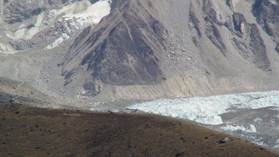
Looking down at Lobuche
As we stood there and scanned the horizon everything suddenly became familiar. Inmarsat moved its satellites around earlier this year to enhance global coverage. In so doing it made an easy shot much harder. For a while some of us were not sure we’d be able to use our gear from base camp. So we fidded with Google Earth, and some other tools, talked to experts, and decided it was going to be a close call either way. We found out later, when a Sherpa went ahead with a BGAN satphone, that things would work after all.
Having used satellite derived imagery to fly over this area in great detail so as to try and figure out satellite viewing angles, I have found myself rather adept at figuring out where I am (with help from Tashi, of course). In many ways, it is almost as if I have been here before.
As we climbed higher we could soon see the Khumbu Glacier, and eventually, Everest Base Camp itself. It was quite easy to pick out the larger yellow tents that teams used for dining. As we got higher we could see the entire expanse of Base Camp. We could also see Kala Pattar quite well. We’ll tackle that hill tomorrow.
Everest Base Camp as seen from above Lobuche
We stopped just short of the summit when several rocks begged us to sit down. We had started at 4,859 meters and ended at 5,111 meters. Everest Base Camp is at 5,300 meters – 17,388 feet. So I am very close to my final altitude. At this point I feel stronger than ever with not the slightest hints of altitude sickness while exercising or resting. As such I am confident that I will arrive at Everest Base Camp darned close to fully functional. As for how long that lasts, that is another issue – and only time will tell. Some times people develop symptoms only after being at high altitude for a while.

Kala Pattar as seen from a hill overlooking Lobuche. We’ll be climbing that tomorrow to get a stunning view of Everest.
I am not expecting to be able to update until Everest Base Camp but I will try from Gorak Shep.
Namaste
Keith


