Image: Hurricane Isaac at Night
Early on August 29, 2012, the Visible Infrared Imaging Radiometer Suite on the Suomi-NPP satellite captured this nighttime view of Hurricane Isaac and the cities near the Gulf Coast of the United States. The image was acquired at 1:57 a.m. local time by the VIIRS “day-night band,” which detects light in a range of wavelengths from green to near-infrared and uses light intensification to enable the detection of dim signals. In this case, the clouds of Isaac were lit by moonlight.
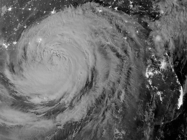
Early on August 29, 2012, the Visible Infrared Imaging Radiometer Suite on the Suomi-NPP satellite captured this nighttime view of Hurricane Isaac and the cities near the Gulf Coast of the United States. The image was acquired at 1:57 a.m. local time by the VIIRS “day-night band,” which detects light in a range of wavelengths from green to near-infrared and uses light intensification to enable the detection of dim signals. In this case, the clouds of Isaac were lit by moonlight.
Issac, a slow-moving storm, made landfall as a category 1 hurricane near the mouth of the Mississippi River in southwestern Louisiana at about 6:45 p.m. local time on August 28, 2012. Larger image


