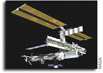
NASA Space Station On-Orbit Status 30 May 2004

All ISS systems continue to function nominally except those noted previously. Second off-duty day for the crew. Ahead: Week 5 of Expedition 9.
Early in the morning, working off the Russian discretionary task list prior to his physical exercise, CDR Padalka performed another session with the VC6 “Delta” program’s ETD experiment (Investigation of the Coordination of Eye and Head Movements). [After a calibration with the calibrating unit, the experiment investigated eye and head movement coordination, measured Listing’s plane, and determined the orientation of the vestibulo-ocular coordinate system. Each step required another prior calibration run, using visual target cues or the calibration unit.]
Padalka also completed the weekly data collection of the Service Module (SM)’s toilet flush counter readings, with inspection of the urine collection (SP) & pretreat assembly and water supply status (SVO) counter readings, both for calldown to MCC-M/TsUP. The task today included the regular weekly inspection of the BRPK air/condensate water separator system.
FE/SO Fincke performed the daily leak check of the Lab window’s inter-pane space (“Volume D”), using the “Aeolus” scopemeter with pressure probe. These tests are to continue through 6/7, at which time the leak testing equipment will be disassembled for leak checks on the equipment itself to characterize the “net” leakage rate of the window. [This is to be followed by a detailed ULD (ultrasound leak detector) window inspection (to determine if the tiny leaks found previously with the ULD are venting to Volume D or possibly directly to space). Next will be a fit check of the new protective box brought up by Progress 14P over window ports C & D, and finally installation of the new U-jumper flexhose and protective shield, plus any procedure developed meanwhile for fixing the pinhole leaks.]
Fincke had his weekly PFC (private family conference) via S-band for audio and Ku-band/NetMeeting for video.
Both crewmembers completed their daily 2.5-hr. physical exercise program on TVIS, RED exerciser, and VELO cycle with load trainer.
Padalka conducted the second part of the new task-listed session of the Russian Uragan earth-imaging program, using the Kodak 760 DSC (digital still camera) with 800mm-lens from SM windows #9, now available again in LVLH attitude. After the activities, he commanded the external shutter of window #9 closed again. [Today’s task featured imagery of the Nureksky and Rogunsky hydropower facilities, the Pamir glaciers Medvezhiy and RGO, and Lakes Issyk Kul and Baikal, including panoramic shots of the latter’s region to assess ice condition.]
The CDR also performed the second part of the task-listed session of the “Diatomeya” ocean observations program, using the DSR PD-150P video camera and Nikon F5 digital still camera with 24/85-mm lens to collect photo and video data on cloud cover structure and color fields of bioproductive areas in ocean waters. [Uplinked suggested targets today specified the North Atlantic in the South delta between Gulf Stream and North Atlantic Drift, focusing on algae blooms in flight traverse.]
Using the Nikon D1 (800mm-lens), Gennady took areal photography for Russia’s Environmental Safety Agency (ECON). [Target regions for today again were Sevastopol, Novorossiysk, Yeisk, and Volgograd, the first three to image oil spills, the last to help assess local flooding.]
Today’s optional CEO (Crew Earth Observations) photo targets, in the current LVLH attitude no longer limited by flight rule constraints on the use of the Lab nadir/science window, except for the shutter closure and condensation-prevention plan (limited to 90 min. in 24 hours), were Bombay, India (looking a touch right for the bay and peninsula where Bombay is located), Aral Sea (nadir pass over center of the depression. One or two images to show the whole basin and complement available detailed images were requested. Looking left and right of track), Glacial Features, SW Libya (when Africa was centered over the South Pole around 450 million years ago, the Sahara was occupied by a continental ice sheet. Rivers of melt water flowed under the ice, forming meandering courses that are re-exposed by erosion today and can be made out from orbit. Space images are key to reconstruction of the wider sub-ice river network. Also, it is suspected that the river channels may host hydrocarbons in places. The crew was to try for a mapping pass of overlapping, nadir images), Internal waves, Aegean Sea (looking left for any internal waves), Athens, Greece (nadir pass), Istanbul, Turkey (a recent image published on NASA’s Earth Observatory website showed a wide oblique view of the Istanbul region. Weather should hold up to allow the whole city to be imaged in one or two shots), and Iguazu, Argentina (this city lies at the junction of Brazil, Argentina and Paraguay and is one of the fastest growing cities in South America).
CEO images can be viewed at the websites.
See also the website “Space Station Challenge” at
ISS Orbit (as of this morning, 7:47am EDT [= epoch]):
- Mean altitude — 362.9 km
- Apogee — 366.9 km
- Perigee — 358.9 km
- Period — 91.8 min.
- Inclination (to Equator) — 51.6327 deg
- Eccentricity — 0.000594
- Solar Beta Angle — 5.9 deg
- Orbits per 24-hr. day — 15.68
- Mean altitude loss in last 24 hours — 125 m
- Revolutions since FGB/Zarya launch (Nov. ’98) — 31553
For more on ISS orbit and worldwide ISS naked-eye visibility dates/times, see
http://www.hq.nasa.gov/osf/station/viewing/issvis.html


