NASA Mars Picture of the Day: Polar Unconformity 08-19-2004
Mars Global Surveyor Mars Orbiter Camera
MGS MOC Release No. MOC2-823, 19 August 2004
 NASA/JPL/Malin Space Science Systems |
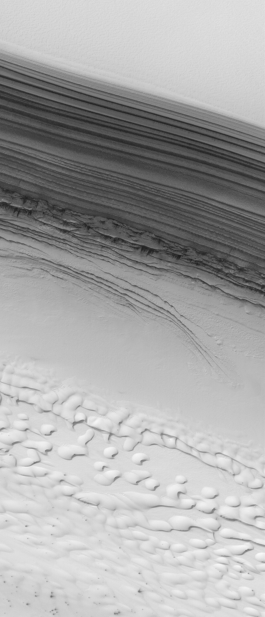
The arrows in this July 2004
Mars Global Surveyor (MGS) Mars Orbiter Camera (MOC)
image indicate the location of an unconformity in
the layered sequence of the martian north polar cap.
An unconformity is a geologic term that indicates
a break in the depositional record of a sedimentary
deposit. In this case, the change is recorded by the
presence of a series of polar layers that are truncated
(cut off) along the line of arrows. The erosion that
cut these layers along a gentle slope were later covered
by a new set of layers that occur from the arrow
tips upward to the top of the sequence shown here.
The image is located
near 85.2°N, 7.3°W. The bright features
in the lower third of the image are frost-covered
sand dunes. The image covers an area about 3 km (1.9 mi)
across and sunlight illuminates the scene from the top/upper right.
To see the same image, but without the arrows,
Click Here (1.9 MByte GIF).
Malin Space Science Systems and the California Institute of Technology
built the MOC using spare hardware from the Mars Observer mission.
MSSS operates the camera from its facilities in San Diego, California.
The Jet Propulsion Laboratory’s Mars Surveyor Operations Project
operates the Mars Global Surveyor spacecraft with its industrial
partner, Lockheed Martin Astronautics, from facilities in Pasadena,
California and Denver, Colorado.


