NASA Mars Picture of the Day: Polar Layers and Dunes
Mars Global Surveyor Mars Orbiter Camera
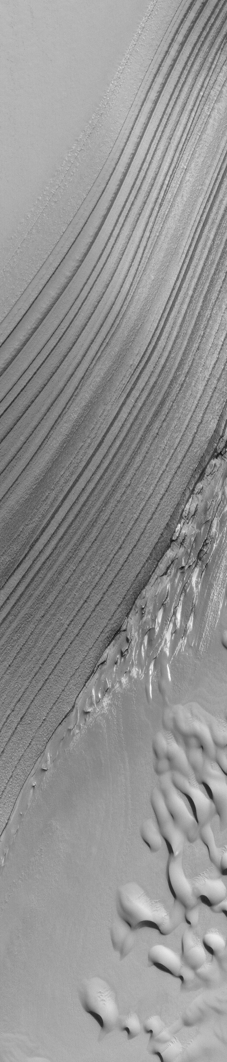
MGS MOC Release No. MOC2-796, 23 July 2004
 NASA/JPL/Malin Space Science Systems |
Acquired just a few days ago on 21 July 2004, this 1.7 m/pixel (5.6 ft/pixel) Mars Global Surveyor (MGS) Mars Orbiter Camera (MOC) image shows layer outcrops and sand dunes in the Chasma Boreale portion of the martian north polar cap. At this time, it is spring and these polar landforms are still covered by frost left over from the winter that ended back in March 2004. In summer, the dunes in this image will be darker than anything else in the scene. The picture is located near 85.1°N, 3.7°W, and covers an area about 1.5 km (0.9 mi) wide. This view is illuminated by sunlight from the upper right.
Malin Space Science Systems and the California Institute of Technology
built the MOC using spare hardware from the Mars Observer mission.
MSSS operates the camera from its facilities in San Diego, California.
The Jet Propulsion Laboratory’s Mars Surveyor Operations Project
operates the Mars Global Surveyor spacecraft with its industrial
partner, Lockheed Martin Astronautics, from facilities in Pasadena,
California and Denver, Colorado.


