NASA Mars Picture of the Day: Opportunity Site: Before and After
Mars Global Surveyor Mars Orbiter Camera
MGS MOC Release No. MOC2-635, 13 February 2004
 NASA/JPL/Malin Space Science Systems |
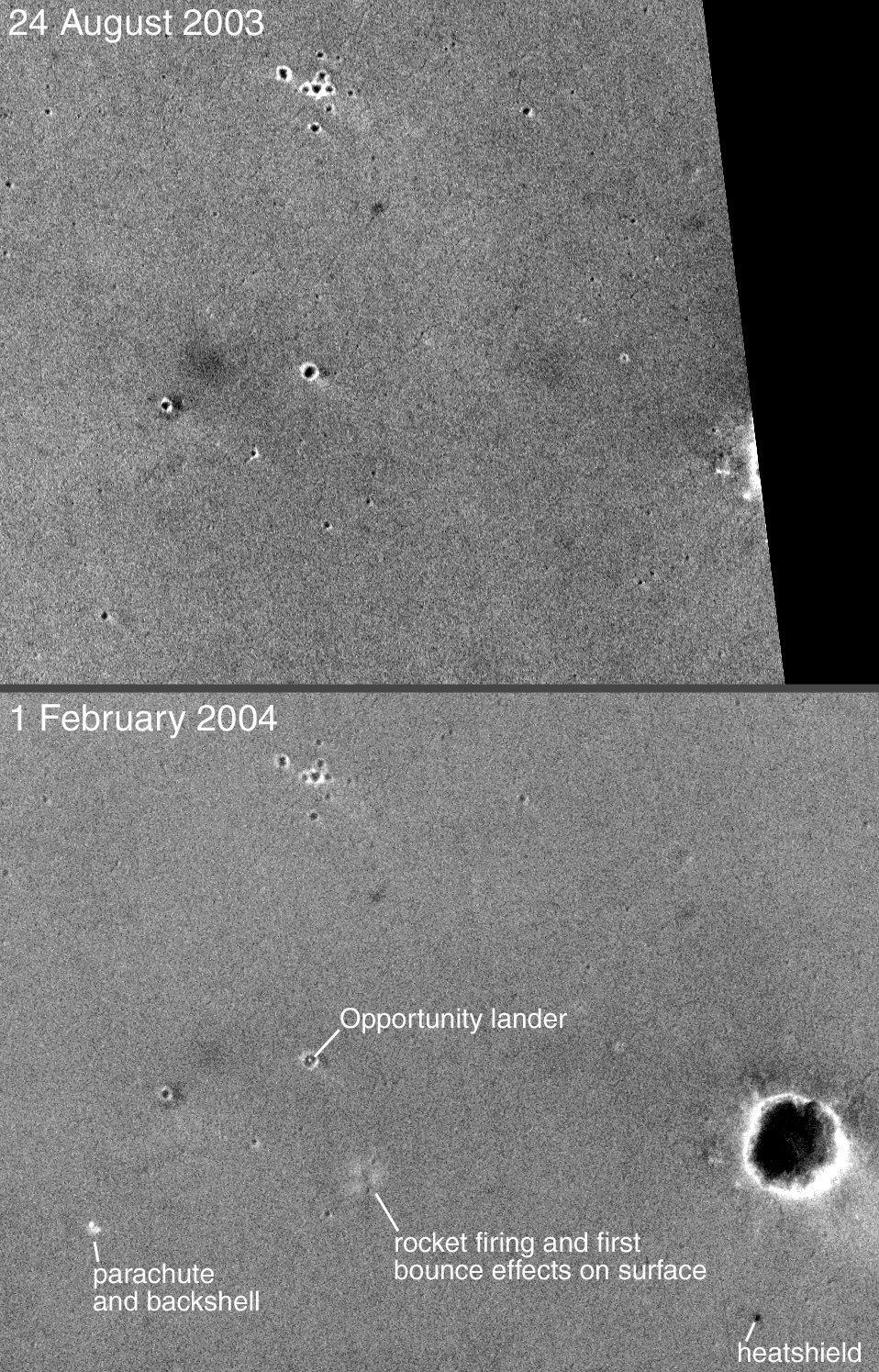
This pair of Mars Global Surveyor (MGS) Mars Orbiter Camera (MOC)
narrow angle images shows the landing site of the Mars Exploration
Rover (MER-B), Opportunity, before and after the landing. The first
image was acquired on 24 August 2003, five months prior to the
25 January 2004 landing. The second picture, obtained on
1 February 2004, shows the
lander–located within a ~20 meter (~66 feet) diameter
crater–and other features that resulted from the landing.
The Opportunity landing site is located in Meridiani Planum
near 2.0°S, 5.6°W.
Both images are simple cylindrical map projections
with north up and east to the right; the lower image is about
1.4 kilometers (0.9 miles) wide. The dark area on the right side
of the upper picture was not imaged by MOC until after the landing.
Sunlight illuminates each scene from the lower left.
For additional MGS MOC views of the Opportunity landing site, see:
- MGS MOC Images of Mars Exploration Rover, Opportunity, on Mars 9 February 2004
- Mars Exploration Rover (MER-B) Opportunity Landing Site 24 January 2004
Malin Space Science Systems and the California Institute of Technology
built the MOC using spare hardware from the Mars Observer mission.
MSSS operates the camera from its facilities in San Diego, California.
The Jet Propulsion Laboratory’s Mars Surveyor Operations Project
operates the Mars Global Surveyor spacecraft with its industrial
partner, Lockheed Martin Astronautics, from facilities in Pasadena,
California and Denver, Colorado.


