NASA Mars Picture of the Day: Gullies and Dunes 06-01-2004
Mars Global Surveyor Mars Orbiter Camera
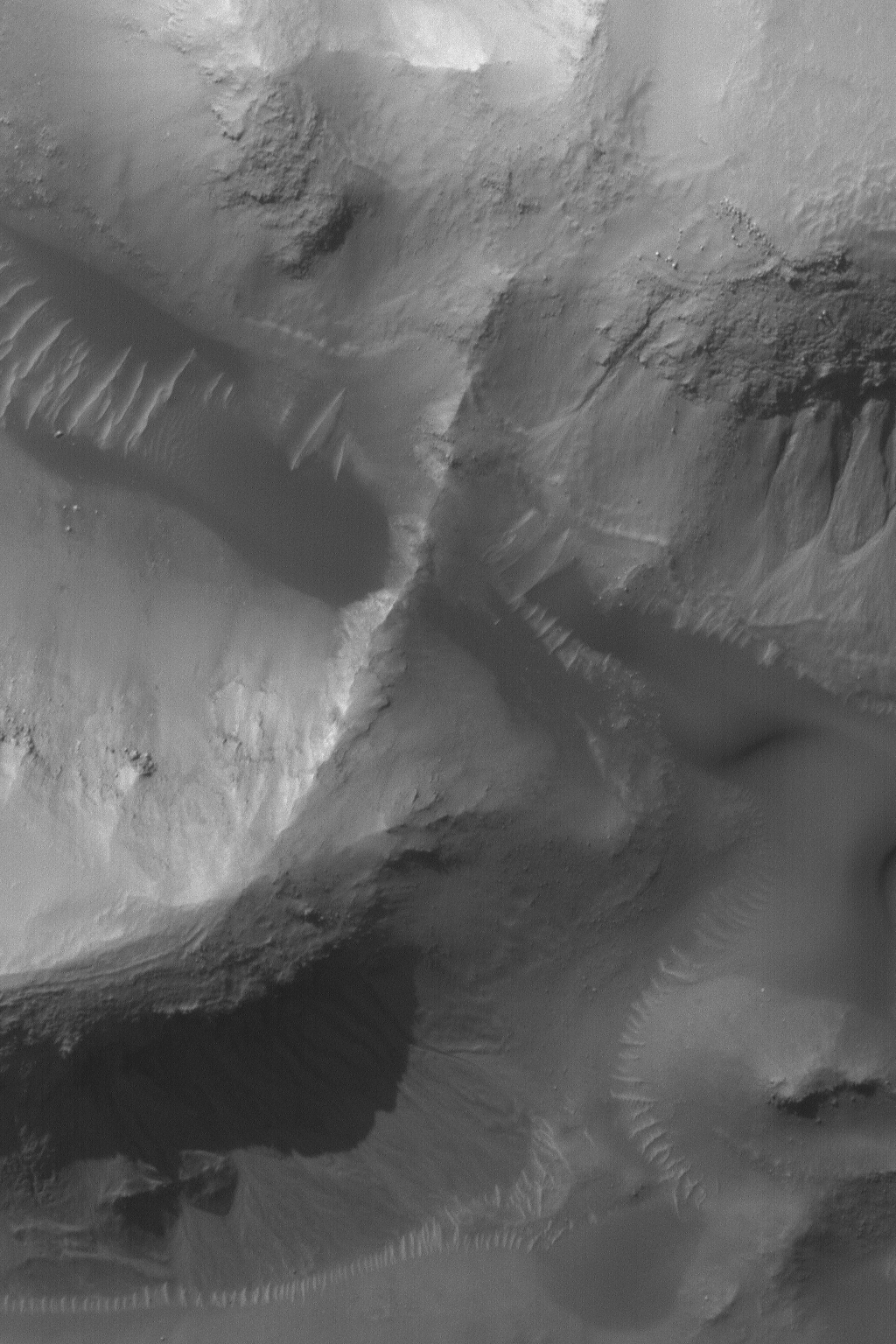
MGS MOC Release No. MOC2-745, 2 June 2004
 NASA/JPL/Malin Space Science Systems |
This 1.5 meters (5 ft.) per pixel
Mars Global Surveyor (MGS) Mars Orbiter Camera (MOC)
image of gullies and dunes in a crater near Gorgonum
Chaos was acquired in late May 2004. The gullies
may have formed by a combination of processes. Many
middle- and polar-latitude gullies such as these
are thought to form both by mass movement of dry
materials and action of liquid water. Some
investigators suggest alternative fluids such
as carbon dioxide. Still others make a case that
no fluid was involved at all. Some gullies on Mars
show clear association with subsurface layering and
undermining of those layers; they also show banked
channels; these kinds of observations are usually
taken in support of the water hypothesis.
The crater in which
the landforms shown here occur is located
at 37.5°S, 169.3°W. This image
covers an area about 1.5 km (0.9 mi) across. The
scene is illuminated by sunlight from the upper left.
Malin Space Science Systems and the California Institute of Technology
built the MOC using spare hardware from the Mars Observer mission.
MSSS operates the camera from its facilities in San Diego, California.
The Jet Propulsion Laboratory’s Mars Surveyor Operations Project
operates the Mars Global Surveyor spacecraft with its industrial
partner, Lockheed Martin Astronautics, from facilities in Pasadena,
California and Denver, Colorado.


