NASA Mars Picture of the Day: Exposing Memnonia Terrain
Mars Global Surveyor Mars Orbiter Camera
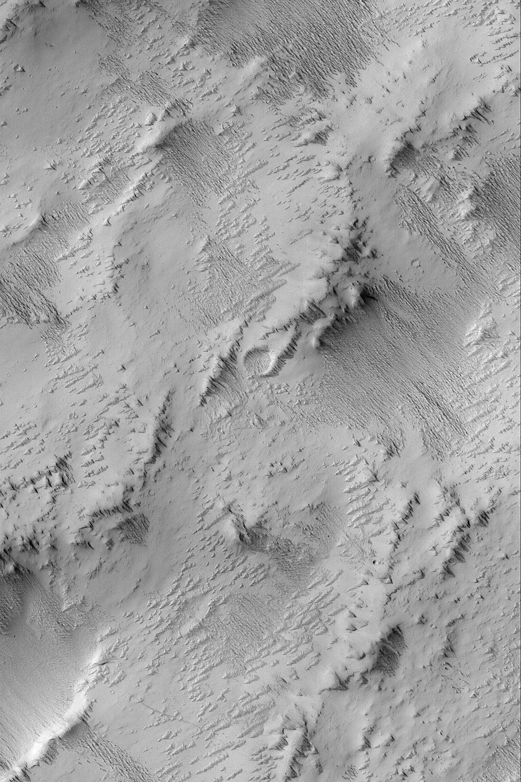
MGS MOC Release No. MOC2-764, 21 June 2004
 NASA/JPL/Malin Space Science Systems |
This Mars Global Surveyor (MGS) Mars Orbiter Camera (MOC)
image shows the results of a process that is underway
in the Memnonia uplands
near 12.9°S, 152.7°W, to strip away one layer
of material and reveal a formerly-buried landscape from
beneath. All of the area shown here was once covered by
a material that has been eroded by wind to form the
sharp-crested, nearly-parallel ridges that run diagonally
from the upper left toward lower right in this image.
These ridges are a classic wind erosion form, known
as a yardang. The image
covers an area about 3 km (1.9 mi) wide and is
illuminated by sunlight from the left/upper left.
Malin Space Science Systems and the California Institute of Technology
built the MOC using spare hardware from the Mars Observer mission.
MSSS operates the camera from its facilities in San Diego, California.
The Jet Propulsion Laboratory’s Mars Surveyor Operations Project
operates the Mars Global Surveyor spacecraft with its industrial
partner, Lockheed Martin Astronautics, from facilities in Pasadena,
California and Denver, Colorado.


