NASA Mars Picture of the Day: East Candor Layers 10-08-2003
Mars Global Surveyor Mars Orbiter Camera
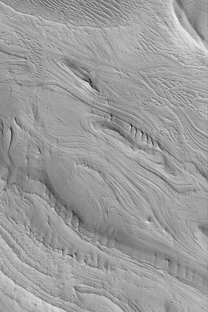
MGS MOC Release No. MOC2-507, 8 October 2003
 NASA/JPL/Malin Space Science Systems |
The Mars Global Surveyor (MGS) Mars Orbiter Camera (MOC)
experiment was designed to study the geology and geomorphology
of Mars by providing images comparable in resolution to the
aerial photographs used by terrestrial geologists in conducting
their field work. For over six years, the MOC narrow angle
camera has been returning pictures that underscore, time and
again, the layered nature of the upper martian crust. It is
from layered rock that geologists will one day be able to
decipher the history of the red planet. This example
of layered rock exposures occurs in eastern Candor Chasma,
one of the troughs of the Valles Marineris system. The
picture is located near 8.0°S, 67.0°W, and
covers an area 3 km (1.9 mi) wide. The image is illuminated
by sunlight from the lower left.
Malin Space Science Systems and the California Institute of Technology
built the MOC using spare hardware from the Mars Observer mission.
MSSS operates the camera from its facilities in San Diego, California.
The Jet Propulsion Laboratory’s Mars Surveyor Operations Project
operates the Mars Global Surveyor spacecraft with its industrial
partner, Lockheed Martin Astronautics, from facilities in Pasadena,
California and Denver, Colorado.


