NASA Mars Picture of the Day: Crater in Cydonia
Mars Global Surveyor Mars Orbiter Camera
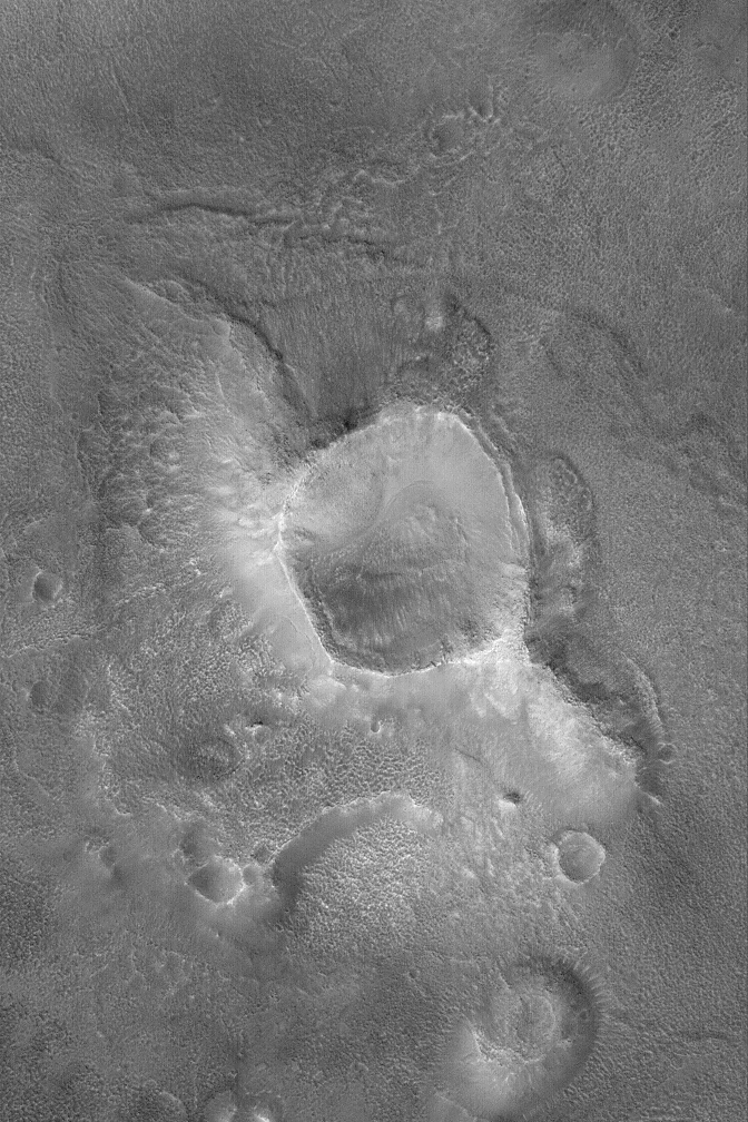
MGS MOC Release No. MOC2-681, 30 March 2004
 NASA/JPL/Malin Space Science Systems |
Erosion has created a wide variety of landforms in the
Cydonia region of Mars. Located in a zone of transition from
cratered highlands to northern plains, Cydonia is a jumble of
thousands of massifs, mesas, buttes, and hills—remnants
of ancient cratered highlands in a state of advance erosion.
This Mars Global Surveyor (MGS) Mars Orbiter Camera (MOC)
image shows a crater, slightly smaller than the famous
1 kilometer-diameter (0.62 miles) Meteor Crater in Arizona, U.S.A.,
that has been left standing high relative to the surrounding
terrain because erosion removed most of the rock into which
this crater originally formed. Later processes have mantled
the crater and surroundings with debris that, at a finer scale,
has also been eroded over time. This image occurs
near 40.1°N, 13.6°W, and
covers an area about 3 km (1.9 mi) across.
Sunlight illuminates the scene from the lower left.
Malin Space Science Systems and the California Institute of Technology
built the MOC using spare hardware from the Mars Observer mission.
MSSS operates the camera from its facilities in San Diego, California.
The Jet Propulsion Laboratory’s Mars Surveyor Operations Project
operates the Mars Global Surveyor spacecraft with its industrial
partner, Lockheed Martin Astronautics, from facilities in Pasadena,
California and Denver, Colorado.


