NASA Mars Odyssey THEMIS Image: MSIP: Hale Crater
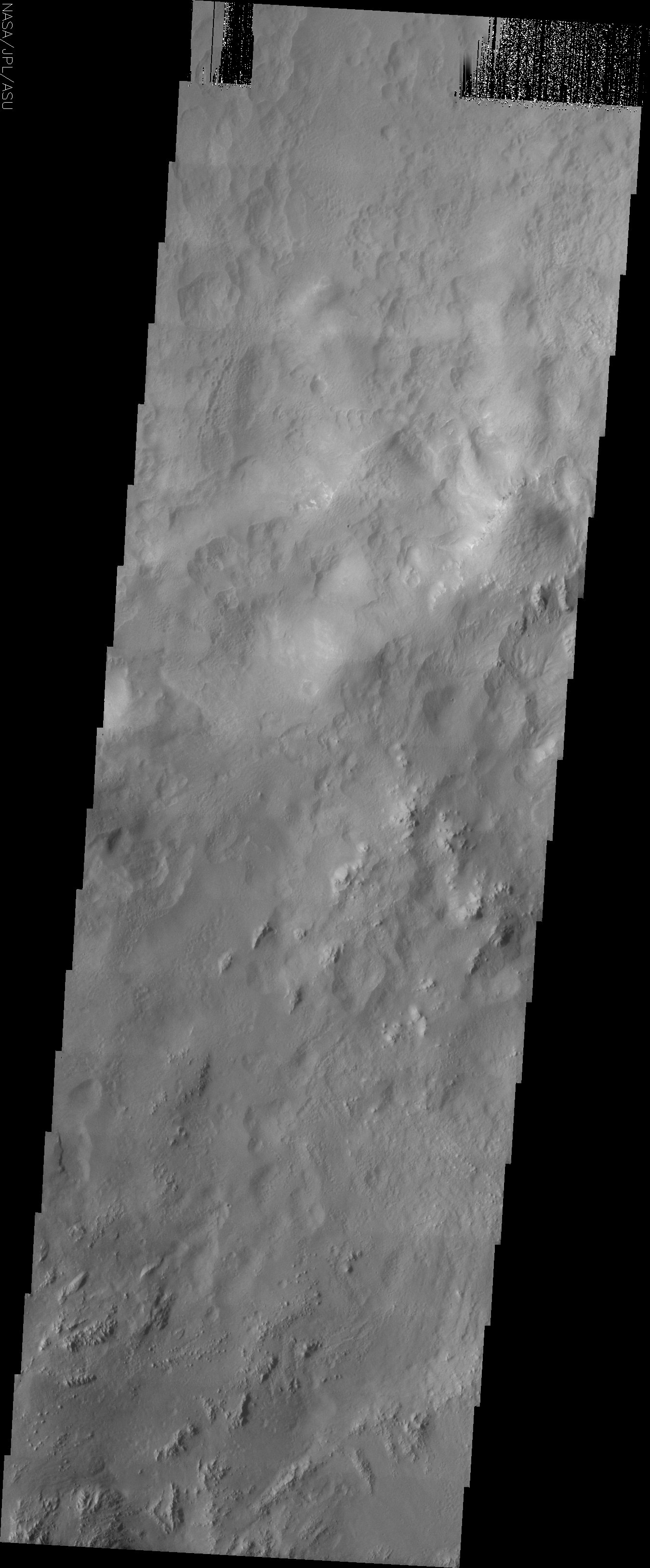 Image Context:  Context image credit: NASA/Mars Orbiter Laser Altimeter (MOLA) Team [ Find on map: Javascript version ] [ Find on map: CGI version ]
This image is part of the following themes: This image was taken by the Mercury Mine 5th grade MSIP team in order to answer the question РIs there water erosion on crater walls? It is located at Hale Crater, lat. 33.1S and long. 324.4E. It shows a crater wall with smaller craters and groves. This MSIP team consists of 22 5th graders at Mercury Mine Elementary in the Paradise Valley school district. Our instructor is Mr. Collins. We started the program in early October 2003 and went to ASU in March of 2004. All in all we had a GREAT time! NASA and Arizona State University’s Mars Education Program is offering students nationwide the opportunity to be involved in authentic Mars research by participating in the Mars Student Imaging Project (MSIP). Teams of students in grades 5 through college sophomore level have the opportunity to work with scientists, mission planners and educators on the THEMIS team at ASU’s Mars Space Flight Facility, to image a site on Mars using the THEMIS visible wavelength camera. For more information go to the MSIP website: http://msip.asu.edu. [Source: ASU THEMIS Science Team] Note: this THEMIS visual image has not been radiometrically nor geometrically calibrated for this preliminary release. An empirical correction has been performed to remove instrumental effects. A linear shift has been applied in the cross-track and down-track direction to approximate spacecraft and planetary motion. Fully calibrated and geometrically projected images will be released through the Planetary Data System in accordance with Project policies at a later time.
Image Credit: NASA/JPL/Arizona State University | ||||||||||||||||||||
| [ Show Full-Size Image (GIF) ] [ Show Full-Size Image (JPG) ] | ||||||||||||||||||||
| [ Show Full-Size Image (PNG) ] [ Show Full-Size Image (TIF) ] | ||||||||||||||||||||
| [ Printer-friendly version ] |


