NASA Mars Odyssey THEMIS Image: Basaltic Crater in Color IR
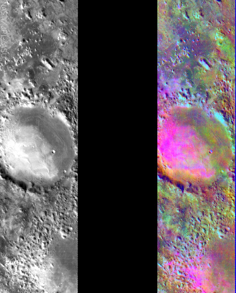 Image Context:  Context image credit: NASA/Mars Orbiter Laser Altimeter (MOLA) Team [ Find on map: Javascript version ] [ Find on map: CGI version ]
Full data on this image has now been released via the THEMIS Data Releases website. This image shows two representations of the same infra-red image near Nili Fosse in the the Isidis region of Mars. On the left is a grayscale image showing surface temperature, and on the right is a false-color composite made from 3 individual THEMIS bands. The false-color image is colorized using a technique called decorrelation stretch (DCS), which emphasizes the spectral differences between the bands to highlight compositional variations. In many cases craters trap sand in their topographic depressions, interrupting the sand’s migration across the Martian surface. This image is particularly interesting because there appears to be more than 1 type of sand in the bottom of this crater and in the hummocky terrain near the bottom of the image. The pink/magenta areas are characteristic of a basaltic composition, but there are also orange areas that are likely caused by the presence of andesite. These two compositions, basalt and andesite, are some of the most common found on Mars. [Source: ASU THEMIS Science Team] Note: this THEMIS infrared image has not been radiometrically nor geometrically calibrated for this preliminary release. An empirical correction has been performed to remove instrumental effects. A linear shift has been applied in the cross-track and down-track direction to approximate spacecraft and planetary motion. Fully calibrated and geometrically projected images will be released through the Planetary Data System in accordance with Project policies at a later time.
Image Credit: NASA/JPL/Arizona State University | ||||||||||||||||||||
| [ Show Full-Size Image (GIF) ] [ Show Full-Size Image (JPG) ] | ||||||||||||||||||||
| [ Show Full-Size Image (PNG) ] [ Show Full-Size Image (TIF) ] | ||||||||||||||||||||
| [ Printer-friendly version ] |


