NASA Mars Odyssey THEMIS Image: Ascraeus Mons Collapse Pits
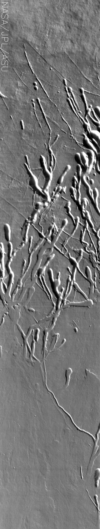 Image Context:  Context image credit: NASA/Mars Orbiter Laser Altimeter (MOLA) Team [ Find on map: Javascript version ] [ Find on map: CGI version ]
Full data on this image has now been released via the THEMIS Data Releases website. We will be looking at collapse pits for the next two weeks. Collapse pits on Mars are formed in serveral ways. In volcanic areas, channelized lava flows can form roofs which insulate the flowing lava. These features are termed lava tubes on Earth and are common features in basaltic flows. After the lava has drained, parts of the roof of the tube will collapse under its own weight. These collapse pits will only be as deep as the bottom of the original lava tube. Another type of collapse feature associated with volcanic areas arises when very large eruptions completely evacuate the magma chamber beneath the volcano. The weight of the volcano will cause the entire ediface to subside into the void space below it. Structural features including fractures and graben will form during the subsidence. Many times collapse pits will form within the graben. In addition to volcanic collapse pits, Mars has many collapse pits formed when volatiles (such as subsurface ice) are released from the surface layers. As the volatiles leave, the weight of the surrounding rock causes collapse pits to form. These collapse pits are found on the flank of Ascraeus Mons. The pits and channels are all related to lava tube formation and emptying. [Source: ASU THEMIS Science Team] Note: this THEMIS infrared image has not been radiometrically nor geometrically calibrated for this preliminary release. An empirical correction has been performed to remove instrumental effects. A linear shift has been applied in the cross-track and down-track direction to approximate spacecraft and planetary motion. Fully calibrated and geometrically projected images will be released through the Planetary Data System in accordance with Project policies at a later time.
Image Credit: NASA/JPL/Arizona State University | ||||||||||||||||||||
| [ Show Full-Size Image (GIF) ] [ Show Full-Size Image (JPG) ] | ||||||||||||||||||||
| [ Show Full-Size Image (PNG) ] [ Show Full-Size Image (TIF) ] | ||||||||||||||||||||
| [ Printer-friendly version ] |


