Mars Picture of the Day: Martian “Ground Rot”
Mars Global Surveyor Mars Orbiter Camera
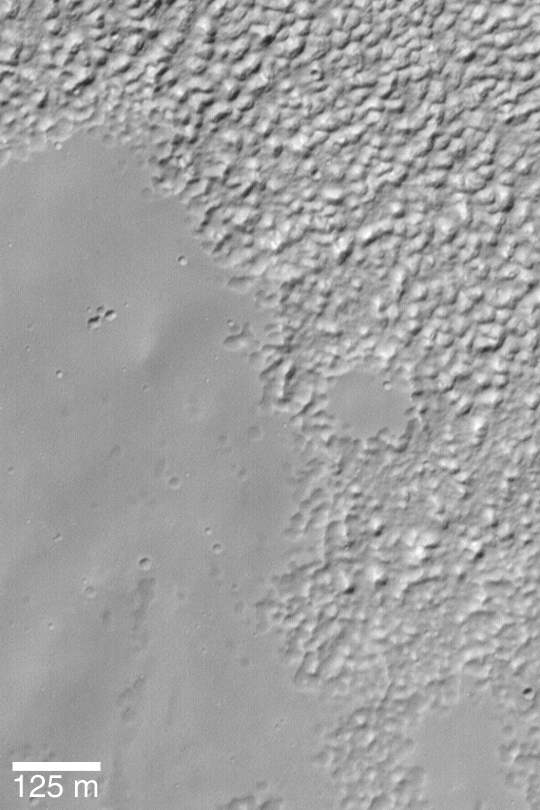
MGS MOC Release No. MOC2-355, 9 May 2003
 NASA/JPL/Malin Space Science Systems |
This Mars Global Surveyor (MGS) Mars Orbiter Camera (MOC) image
shows a typical southern mid-latitude surface at very high resolution.
The smooth-surfaced material (mostly on the left and lower left sides
of the image) erodes and breaks down into the knobby terrain (seen
at the top and right). The exact cause of this degradation of smooth-surfaced
material at middle latitudes is unknown. One speculation is that the
materials are a mixture of water ice, dust, and silt; when the ice sublimes
away, it leaves behind the knobby terrain.
The image is located near
37.0°S, 84.0°W.
Sunlight illuminates the scene from the
upper left.
Malin Space Science Systems and the California Institute of Technology
built the MOC using spare hardware from the Mars Observer mission.
MSSS operates the camera from its facilities in San Diego, California.
The Jet Propulsion Laboratory’s Mars Surveyor Operations Project
operates the Mars Global Surveyor spacecraft with its industrial
partner, Lockheed Martin Astronautics, from facilities in Pasadena,
California and Denver, Colorado.


