Mars Picture of the Day: Layered Yardangs in Henry Crater
Mars Global Surveyor Mars Orbiter Camera
MGS MOC Release No. MOC2-389, 12 June 2003
 NASA/JPL/Malin Space Science Systems |
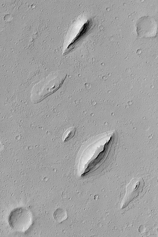
This Mars Global Surveyor (MGS) Mars Orbiter Camera (MOC)
image shows wind-sculpted remnants of layered sedimentary
rock that once completely covered the northwestern floor
of Henry Crater, an ancient impact basin located at
11.7°N, 336.4°W. These landforms, shaped somewhat
like inverted boat hulls, are “textbook examples” of
a wind erosion form known as a yardang.
The image covers an area 2.3 km (1.4 mi) wide;
sunlight illuminates the scene from the left.
Malin Space Science Systems and the California Institute of Technology
built the MOC using spare hardware from the Mars Observer mission.
MSSS operates the camera from its facilities in San Diego, California.
The Jet Propulsion Laboratory’s Mars Surveyor Operations Project
operates the Mars Global Surveyor spacecraft with its industrial
partner, Lockheed Martin Astronautics, from facilities in Pasadena,
California and Denver, Colorado.


