Mars Odyssey THEMIS Image: Promethei Terra
 |
|
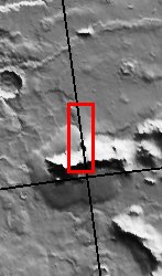
| This image shows a landslide along a portion of a ridge in Promethei Terra. Landslides have very characteristic morphologies on Earth, which they also display on Mars. These morphologies include a distinctive escarpment at the uppermost part of the landslide–called a head scarp (seen at the bottom of this image), a down-dropped block of material below that escarpment that dropped almost vertically, and a deposit of debris that moved away from the escarpment at high speed. In this example, the wall rock displayed in the upper part of the cliff contains spurs and chutes created by differing amounts of erosion. The actual landslide deposit shows transverse ribs which are probably compressional features created upon emplacement of the landslide material. This image also contains a smoother plains member located in the upper part of the image and a somewhat rougher less cratered unit located below the smoother plains. This rougher unit is actually a debris apron surrounding the ridge (see context image). There are also what appear to be older more degraded landslide scars visible along the eastern portion of this ridge.
[Questions? Email images@themis.asu.edu] [Source: ASU THEMIS Science Team] |
NASA’s Jet Propulsion Laboratory manages the 2001 Mars Odyssey mission for NASA’s Office of Space Science, Washington, D.C. The Thermal Emission Imaging System (THEMIS) was developed by Arizona State University, Tempe, in collaboration with Raytheon Santa Barbara Remote Sensing. The THEMIS investigation is led by Dr. Philip Christensen at Arizona State University. Lockheed Martin Astronautics, Denver, is the prime contractor for the Odyssey project, and developed and built the orbiter. Mission operations are conducted jointly from Lockheed Martin and from JPL, a division of the California Institute of Technology in Pasadena.
Image Credit: NASA/JPL/Arizona State University
| Parameter | Value | Parameter | Value | |
|---|---|---|---|---|
| Latitude | -44.4 |   | Instrument | VIS |
| Longitude | 105E (255W) |   | Resolution (m) | 19 |
| Image Size (pixels) | 3061×1175 |   | Image Size (km) | 58.2×22.3 |


