Mars Odyssey THEMIS Image: Libya Montes
 |
|
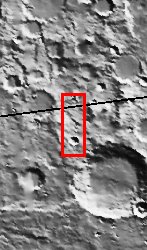
| This image shows the rugged cratered highland region of Libya Montes. Libya Montes forms part of the rim of an ancient impact basin called Isidis. This region of the highlands is fairly dissected with valley networks. There is still debate within the scientific community as to how valley networks themselves form: surface runoff (rainfall/snowmelt) or headward erosion via groundwater sapping. The degree of dissection here in this region suggests surface runoff rather than groundwater sapping. Small dunes are also visible on the floors of some of these channels.
[Questions? Email images@themis.asu.edu] [Source: ASU THEMIS Science Team] |
NASA’s Jet Propulsion Laboratory manages the 2001 Mars Odyssey mission for NASA’s Office of Space Science, Washington, D.C. The Thermal Emission Imaging System (THEMIS) was developed by Arizona State University, Tempe, in collaboration with Raytheon Santa Barbara Remote Sensing. The THEMIS investigation is led by Dr. Philip Christensen at Arizona State University. Lockheed Martin Astronautics, Denver, is the prime contractor for the Odyssey project, and developed and built the orbiter. Mission operations are conducted jointly from Lockheed Martin and from JPL, a division of the California Institute of Technology in Pasadena.
Image Credit: NASA/JPL/Arizona State University
| Parameter | Value | Parameter | Value | |
|---|---|---|---|---|
| Latitude | -5.3 |   | Instrument | VIS |
| Longitude | 88.2E (271.8W) |   | Resolution (m) | 19 |
| Image Size (pixels) | 3043×1239 |   | Image Size (km) | 57.8×23.5 |


