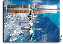
ISS On-Orbit Status 12 May 2002
 All ISS systems continue to function nominally, except as noted
previously or below. Week 22 for Expedition 4, and just 18 days
left until STS-111/UF-2 launch.
The crew had another day off, after doing great work yesterday
reducing the task list and finishing up on ZSR (zero-G storage rack)
reconfigurations. Undoubtedly, on this Mothers’ Day good use
was made by them of the IP phone.
CDR Yuri Onufrienko completed the daily routine tasks of SP urine
collection system & pretreat assembly inspection, SVO water
supply system checkout, with calldown of supply counter readings, and
BRPK-2 condensate water separator inspection,. He also
performed the regular daily check-up on the SOSH life support
system.
FE-1 Carl Walz performed the daily status check on the autonomous
Inc. 4/8A payloads.
Walz also started out on the final session of the experimental renal
(kidney) stone prevention program by recording his food and liquid
intake in a logbook and preparing the urine collection equipment for
the week ahead. Part of the study is for the subject to ingest either
potassium citrate or placebo tablets and collect urine samples for
analysis on the ground.
All crewmembers performed their daily physical exercise program of
2.5 h each, on RED (resistive exercise device), TVIS (treadmill with
vibration isolation and stabilization) and VELO (Russian cycle
ergometer).
On Friday, 5/10, a remote power control switch in the Node had
tripped, turning off one of the Node lights. The switch was
successfully reclosed by MCC-H yesterday. No evidence of an
overcurrent was seen at the time of the trip, and thanks to the
crew’s help, MCC-H was able to verify the light is working nominally.
The trip is an "unexplained anomaly", and there are
no restrictions to operating the light or the RPCM (remote power
controller module).
Today’s target areas for the CEO (crew earth observation) program
were E. Mediterranean Dust and Smog (after the ISS passed
Greece, clouds should have cleared and permitted to shoot pictures
westward toward the Libyan-Egyptian coast. Strong ENE airflow off
North Africa continues to carry dust out over the eastern
Mediterranean. Photos taken at normal exposures should permit
estimates of thickness of the masses), Oman Runoff/Floods?
(Dynamic Event: By the time of this encounter, the tropical cyclone
over southern Oman was broken up. Crew was to look left of track and
document storm runoff in the wadis and any sediment plumes that might
reach the sea), Kenya Flooding (Dynamic Event: Popcorn cumulus
clouds were likely present but there may have been sufficient gaps in
the clouds to allow the crew to photograph northeastern Lake
Victoria. A persistent storm system has been centered over the area,
giving rise to flooding around the NE lakeshore in Kenya), Mt.
Kilimanjaro (an uncommonly good pass over the ice fields crowning
Kilimanjaro ["Shining Mountain" in Swahili] the
station passed directly over the >29,000-ft peak. There were
probably low clouds in the area, but the summit commonly rises above
the clouds), Post-Kesiny Flooding (Dynamic Event: In the wake
of Tropical Cyclone Kesiny, the rivers of Madagascar will be running
red with sediment washed from this increasingly deforested landscape.
The estuaries of the Mangoky and Betsiboka Rivers will be just left
of track. Of interest: documenting storm runoff, river levels, and
sediment plumes extending out into the Mozambique Channel),
Eastern United States (Okefenokee Swamp fires are worsening,
sending dense smoke plumes NE-ward along the Atlantic coastal plain.
The burning area was immediately left of track, so the crew may have
been able to document individual smoke sources. They were asked to
use the ESC [electronic still camera] with the 300 mm lens; any good
downlinked images will be candidates for posting to Earth
Observatory), High Central Andean Glaciers (this pass followed
the backbone of the Peruvian Andes; the small and receding mountain
glaciers were along track to the right. Of interest: documenting the
extent of snow pack and glaciers), Lake Poopo (Lake Poopo was
just right of track and broad, bright Salar de Uyuni was just beyond.
The crew’s continuing documentation of water levels in these
ephemeral water bodies will serve as baseline data, in advance of the
next postulated El Nino cycle).
CEO images can be viewed at the website http://eol.jsc.nasa.gov
<http://eol.jsc.nasa.gov/> ISS Orbit (as of
this morning, 8:56 am EDT):
Mean altitude — 388.8 km
Apogee — 394.5 km
Perigee — 383.2 km
Period — 92.3 min.
Inclination (to Equator) — 51.64 deg
Eccentricity — 0.0008334
Orbits per 24-hr. day — 15.59
Altitude decrease — 250 m (mean) in last 24 hours
Revolutions since FGB/Zarya launch (Nov. ’98) — 19846
Current Flight Attitude — LVLH (local vertical/local horizontal =
“earth-fixed”: z-axis in local vertical, x-axis in velocity vector
[yaw: -10 deg, pitch: -7.25 deg., roll: 0 deg]).
For more on ISS orbit and naked-eye visibility dates/times, see


