ISS On-Orbit Status 10 Mar 2002
 All ISS systems continue to function nominally, except as noted previously or below. Begin of Week 13.
A quiet, restful day on board, with only the obligatory daily maintenance duties and discretionary task list items.
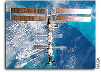
At 3:15 am EST, the crew began preparations for the PAO event, which featured a ship-to-ship comm “bridge” televised live to the ground for taping and later replays. The two-way connection between STS-109/Columbia and ISS was established at 3:32 am (via Ku- and S-band and TDRS), when the two vehicles, carrying a total of ten humans, were about 7200 nautical miles apart (8300 stat. mi. or 13,300 km). At that time, the Shuttle was over the Atlantic, west of Africa, and the station over the South Pacific.
After the PAO event, CDR Yuri Onufrienko performed the regular maintenance tasks, viz., BRPK-1 condensate water separator inspection, calldown of SVO water supply and SP toilet flush usage counter readings, and maintenance of SOSH life support fluid lines and couplings.
All crewmembers completed their regular physical exercise. The RED (resistive exercise device) is currently used with the alternate bungee setup in lieu of the regular Flexpack canisters, until the crew has changed out the frayed cables (on 3/11). After the change-out, the device will have to be recalibrated (on 3/13) in order to perform properly.
For the Russian Uragan earth imaging program, Yuri today was task-listed to document the Medvezhi Glacier with the Rubinar binocular telescopic device, and to use the LIV Betacam video for detailed context views of East Africa, with the Mt. Kenya and Mt. Kilimanjaro volcanoes, and of the African coast, with Northern Madagascar right of the ground track.
In the U.S. CEO (crew earth observations) program, today’s optional target areas were Calcutta, India (this pass overflew two mega cities within seconds of one another. Crew was to shoot for details of Calcutta just to the right or track), Dhaka, Bangladesh (this city was more difficult to see, but was to the left of track just after Calcutta. Few good photos are available for this mega city), Irrawaddy River Delta (optimum lighting and a near nadir pass over the Irrawaddy delta today. Of interest: mapping the details of this delta system and documenting the color and extent of sediment plumes during this low-water season), Malaysia (while not cloud-free, this pass offered excellent viewing opportunities for coral reefs in the lower South China Sea. Crew was to use the ESC [electronic still camera] for nadir views of these features just off the southeast coast of the Malay Peninsula), E. Mediterranean Dust and Smog (as ISS crossed the Balkan Peninsula, crew was to begin looking to the right of track toward Turkey for both smog and Saharan dust clouds and to try for oblique or limb views only), Tropical Cyclone “Hary” (the forecast track for this weather system placed it on the NE coast of Madagascar packing 140-kt winds. Satellite imagery indicated a compact storm with a small eye. If still visible, crew was to try for a nadir view of the eye and any context views of the cloud shield and extent of this dangerous storm), Gulf of St. Lawrence (both illumination and weather are deteriorating for this site. This may have been last ISS pass for a while to capture details of ice buildup in the southern Gulf of St Lawrence), Lake Poopo (despite the likelihood of afternoon thunderstorms in the Altiplano region, this pass was a good one to document the water levels and color of Lake Poopo and the large salars, just to the right of track), and Parana River (crew was to use this pass to document the agricultural activity and vegetation color changes as harvest season begins in this region of the Parana).
ISS Orbit (as of this morning, 7:13am EST):
- Mean altitude — 386.0 km
- Apogee — 389.1 km
- Perigee — 382.8 km
- Period — 92.3 min.
- Inclination (to Equator) — 51.64 deg
- Eccentricity — 0.0004662
- Orbits per 24-hr. day — 15.60
- Altitude decrease — 380 m (mean) in last 24 hours
- Revolutions since FGB/Zarya launch (Nov. ’98) — 18864
- Current Flight Attitude — LVLH (local vertical/local horizontal = “earth-fixed” [yaw: -10 deg, pitch: -7 deg., roll: 0 deg])roll: 0 deg]).
For more on ISS orbit and naked-eye visibility dates/times, see
http://www.hq.nasa.gov/osf/station/viewing/issvis.html


