Record Breaking New England Winter Storm Observed From Space

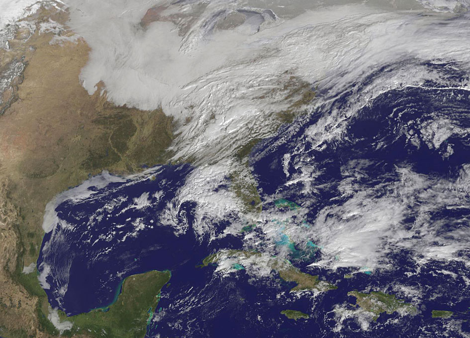
Another large snowstorm affecting New England was dropping more snow on the region and breaking records on February 9, as NOAA’s GOES-East satellite captured an image of the clouds associated with the storm system.
On Feb. 9, NOAA’s National Weather Service in Boston, Massachusetts noted that “The 30-day snowfall total at Boston ending 7 a.m. this morning is 61.6 inches. This exceeds the previous maximum 30 day snowfall total on record at Boston, which was 58.8 inches ending Feb 7 1978.”
The GOES-East image was created by NASA/NOAA’s GOES Project at NASA’s Goddard Space Flight Center in Greenbelt, Maryland. It showed a blanket of clouds over the U.S. northeast that stretched down to the Mid-Atlantic where there was no snow on the ground in Washington, D.C.
NOAA’s National Weather Service Weather Prediction Center provided a look at the extent of the storm system and noted “Heavy snow will impact portions of New York State and New England as the new week begins. Freezing rain will spread from western Pennsylvania to Long Island, with rain for the mid-Atlantic states.” The low pressure area bringing the snow to the northeast was located in central Pennsylvania. A cold front extended southward from the low across the Tennessee Valley while a stationary boundary extended eastward from the low across the central mid-Atlantic.
To create the image, NASA/NOAA’s GOES Project takes the cloud data from NOAA’s GOES-East satellite and overlays it on a true-color image of land and ocean created by data from the Moderate Resolution Imaging Spectroradiometer, or MODIS, instrument that flies aboard NASA’s Aqua and Terra satellites. Together, those data created the entire picture of the storm.
NOAA’s GOES satellites provide the kind of continuous monitoring necessary for intensive data analysis. Geostationary describes an orbit in which a satellite is always in the same position with respect to the rotating Earth. This allows GOES to hover continuously over one position on Earth’s surface, appearing stationary. As a result, GOES provide a constant vigil for the atmospheric triggers for severe weather conditions such as tornadoes, flash floods, hail storms and hurricanes.
For updated information about the storm system, visit NOAA’s NWS website: http://www.weather.gov
For more information about GOES satellites, visit: http://www.goes.noaa.gov/ or goes.gsfc.nasa.gov/


