Orbital View of Tropical Cyclone Amos As It Grows
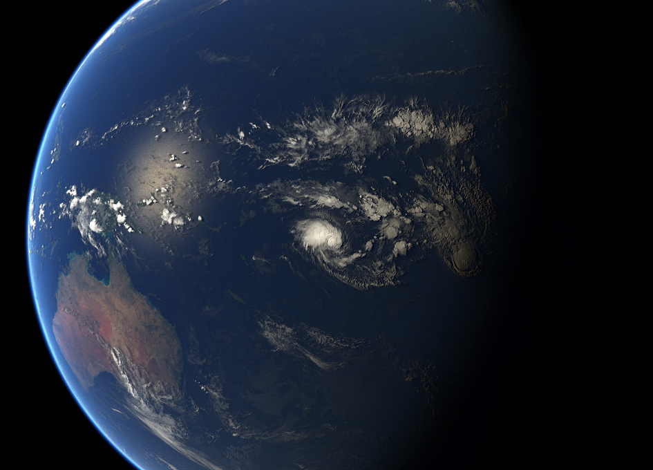
This Composite image of tropical cyclone Twenty (Amos) is from 09:00 UTC on Wednesday, 20 April 2016.
Infrared data from the geostationary satellites of EUMETSAT, JMA and NOAA overlays a computer-generated model of the Earth, containing NASA’s Blue Marble Next Generation imagery.
According to NASA:
Tropical Cyclone 20P, now named Amos, has continued to organize and strengthen in the Southern Pacific and is now threatening Pago Pago.
NOAA’s GOES-West satellite captured an image of the storm on April 21 as a Flash Flood Watch continued for all islands in American Samoa.
From its geostationary position over the Eastern Pacific Ocean, NOAA’s GOES-West satellite captured an image of Tropical Cyclone Amos near Fiji on April 21 at 1200 UTC (8 a.m. EDT) that showed the storm had developed a more organized circulation. The image was created by the NASA/NOAA GOES Project at NASA’s Goddard Space Flight Center in Greenbelt, Maryland.
Animated multispectral satellite imagery showed that the low-level circulation center was slowly consolidating and there were strong thunderstorms obscuring a ragged but defined center. Microwave data showed that a well-defined eye feature had developed underneath the cloud cover. JTWC forecasters noted “This excellent low-level structure, in combination with the radial outflow, suggests an Imminent rapid intensification phase.”
At 0900 UTC (5 a.m. EDT) Tropical Cyclone Amos’ maximum sustained winds had increased to 45 knots (51.7 mph/83.3 kph). The Joint Typhoon Warning Center noted that the storm appears to be intensifying rapidly and is expected to become a hurricane by April 22.
Amos was centered near 13.0 degrees south latitude and 179.3 degrees west longitude, about 507 nautical miles (583.4 miles/939 km) west of Pago Pago, Samoa. Amos was moving to the southeast at 4 knots (4.6 mph/7.4 kph).
The National Weather Service in Pago Pago has issued a Flash Flood Watch for all islands of American Samoa through Saturday, April 23. The NWS noted “increasing rainfall activities and thunderstorms are expected through the weekend. An active surface trough will linger over the Samoan Islands…and this trough will trigger numerous showers through Friday morning (Apr. 22) before the arrival of another series of rainfall activities associated with tropical cyclone Amos during Friday afternoon into Saturday night. The potential threat for flash flooding is possible.” For updated warnings and forecasts, visit NWS, Pago Pago: http://www.weather.gov/ppg.
Amos is forecast to accelerate eastward to southeastward as it tracks along the edge of a near-equatorial steering ridge (elongated area) of high pressure.


