Orbital View As Fires Cover Central Africa
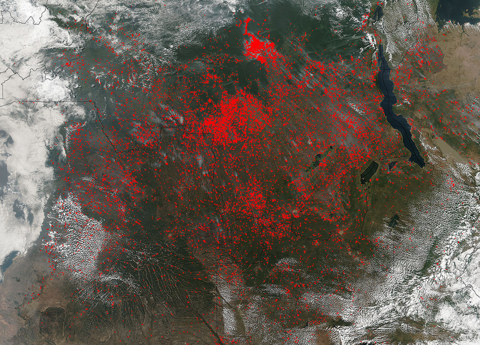
The Suomi NPP satellite’s Visible Infrared Imaging Radiometer Suite (VIIRS) instrument captured a look at huge numbers of fires burning and the resulting smoke in central Africa on June 27, 2017.
Actively burning areas, detected by VIIRS are outlined in red. The fires obscure most of the landscape in central Africa. June heralds the end of the crop season in this part of the world, and these fires may be intentional agricultural fires set by people to rid the area of left over crops and get it ready for the next season. So too some of these may also be lightning strike fires or they may be accidental fires which may have gotten out of control.
The Suomi NPP satellite is a joint mission between NASA and NOAA.
NASA image courtesy Jeff Schmaltz, MODIS Rapid Response Team Larger image


