Fires in India Viewed From Space
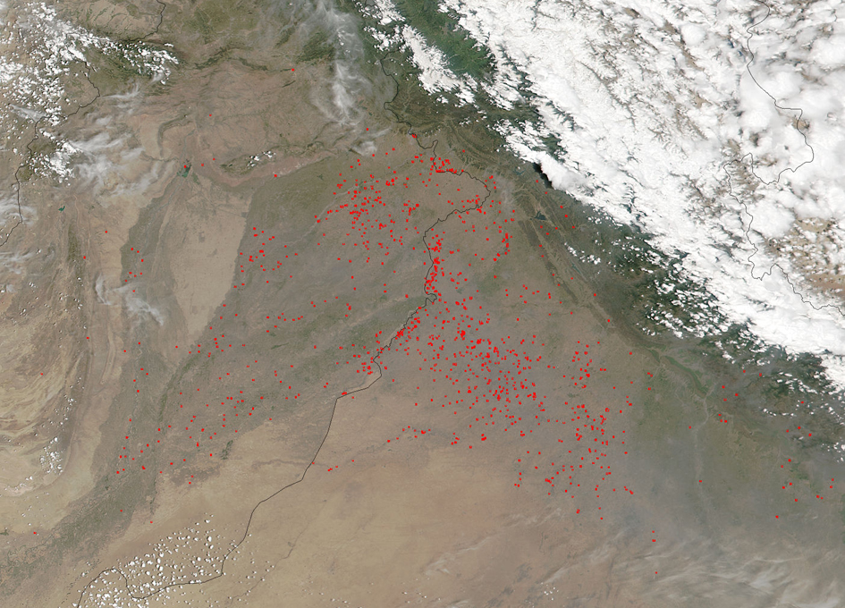
NASA’s Suomi NPP satellite’s Visible Infrared Imaging Radiometer Suite (VIIRS) instrument captured a look at multiple fires and smoke burning in northwest India on May 05, 2017.
Each hot spot, which appears as a red mark, is an area where the thermal detectors recognized temperatures higher than background. When accompanied by plumes of smoke, as in this image, such hot spots are diagnostic for fire. The location, widespread nature, and number of fires suggest that these fires were deliberately set to manage land.
Farmers often use fire to return nutrients to the soil and to clear the ground of unwanted plants. While fire helps enhance crops and grasses for pasture, the fires also produce smoke that degrades air quality. Of course, it is always possible that some of the fires were started by unintentional means such as lightning strikes or accidentally started by humans.
The Suomi NPP satellite is a joint mission between NASA and NOAA.
NASA image courtesy Jeff Schmaltz, MODIS Rapid Response Team. Caption: NASA/Goddard, Lynn Jenner Larger image


