East African Agricultural Fires Overwhelm Landscape
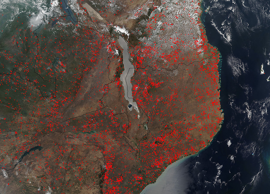
The Suomi NPP satellite’s instrument known as VIIRS (Visible Infrared Imaging Radiometer Suite) detected hundreds of fires burning in eastern Africa on October 15, 2017.
The fires are outlined in red. The location, widespread nature, and number of fires suggest that these fires were deliberately set to manage land. Places where traditional plots of open land is not available because the vegetation in the area is dense are the places where “slash and burn” agriculture is practiced most often. These regions include parts of Africa, northern South America, and Southeast Asia, where an abundance of grasslands and rainforests are found.
Farmers often use fire to return nutrients to the soil and to clear the ground of unwanted plants. While fire helps enhance crops and grasses for pasture, the fires also produce smoke that degrades air quality. In southern Africa, the agricultural burning season usually runs from June through September when the next growing season begins.
NASA image courtesy Jeff Schmaltz, MODIS Rapid Response Team


