Earth from Space – Nushagak Bay, Alaska

The complex and diverse landscape that surrounds Nushagak Bay in Alaska is featured in this true-colour image captured by the Copernicus Sentinel-2 mission in this weeks Earth from Space feature.
Nushagak Bay is a large estuary covering over 100 sq km in southwest Alaska, US. The bay runs primarily north to south from the mouth of the Nushagak River before exiting into Nushagak Bay – an inlet of Bristol Bay some 50 km southwards.
The bay is primarily fed by the Nushagak River (visible in the top right), which begins in the Alaska Range and flows southwest approximately 450 km. The bay is also fed by several additional rivers including the Wood, Igushik, Snake and Weary rivers.
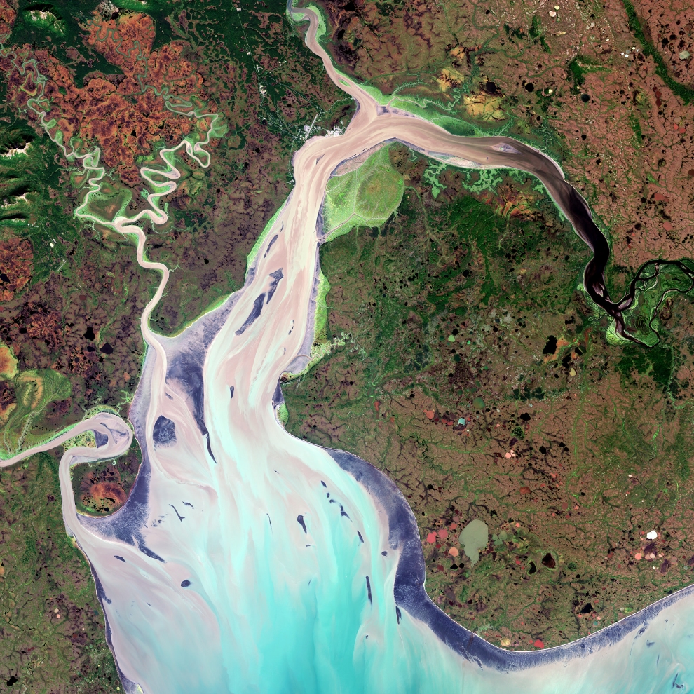
This true-colour image was captured by the Copernicus Sentinel-2 mission. The dark colours of the Nushagak River are most likely due to tannins or lignins (chemical substances found in plants). Tannins and lignins from roots, leaves, seeds, bark and soil can leach into the water and give it a brown or even black colour. The sediments then flow southwards where it is mixed with the bluer waters of the bay.
The largest city in the area is Dillingham, home to around 2000 people, and is surrounded by forests, shrublands, grasslands and mosses. The rivers, as well as the lowlands around Nushagak Bay, are rich with deciduous trees. The dark purple areas along the bay are intertidal mud and sand flats. If you zoom in to the image, a white rim around the southern parts of the bay is visible. Several thaw ponds can also be seen dotted around the image.
Nushagak Bay is an important staging and stopover site for dozens of migratory shorebird and waterfowl species, and it contains one of the largest and most pristine sockeye salmon fisheries in the world.
Sentinel-2 carries a multispectral imager with a swath of 290 km. As well as providing detailed information about Earth’s vegetation, Sentinel-2 is designed to play a key role in mapping differences in land cover to understand the landscape, map how it is used and monitor changes over time.


