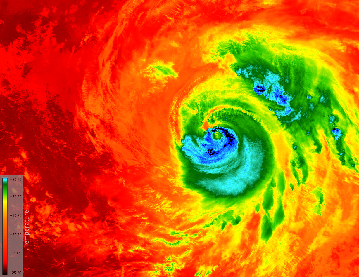
Copernicus Sentinel-3A Temperature Imagery of Hurricane Matthew

This image from Copernicus Sentinel-3A shows the temperature at the top of Hurricane Matthew at 03:13 GMT (05:13 CEST) today, as it approached Florida in the USA.
The temperature of the clouds at the top of the storm, about 12 km from the ocean surface, range from about -80°C just outside the eye of the storm to about 25°C at sea level in the Gulf of Mexico, where it is relatively calm. This monster 400 km-wide hurricane was about 200 km northwest of Miami Beach when the image was taken. Having already caused devastation in the Caribbean, Matthew is the most powerful hurricane to threaten the US Atlantic coast in more than a decade – and it is thought that it could be the most catastrophic to hit Florida in more than a 100 years.
Sentinel-3’s sea and land surface temperature radiometer measures energy radiating from Earth’s surface in nine spectral bands. This is a thermal infrared image at a resolution of 1 km.


