NASA Mars Picture of the Day: Albedo Boundary
Mars Global Surveyor Mars Orbiter Camera
MGS MOC Release No. MOC2-510, 11 October 2003
 NASA/JPL/Malin Space Science Systems |
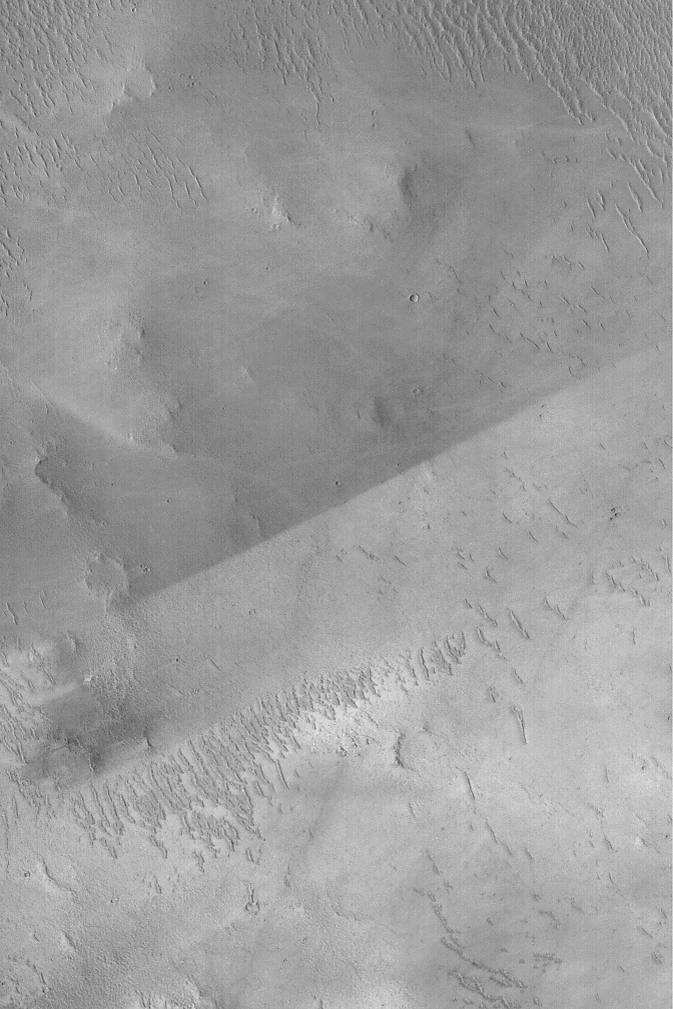
The sharp, nearly straight line that runs diagonally across
the center of this
April 2003 Mars Global Surveyor (MGS) Mars Orbiter Camera (MOC)
image is an albedo boundary. Albedo is a term that
refers to reflectance of sunlight. A surface with a low albedo
is one that appears dark because it reflects less light than
a high albedo (bright) surface. On Mars, albedo boundaries occur
between two materials of differing texture, particle size, or composition,
or some combination of these three factors. The boundary shown
here is remarkable because it is so sharp and straight. This is
caused by wind. Most likely, the entire surface was once covered
with the lower-albedo (darker) material that is now seen in the upper
half of the image. At some later time, wind stripped away this darker
material from the surfaces in the lower half of the image. The
difference in albedo here might be related to composition,
and possibly particle size. This picture is located near the
southwest rim of Schiaparelli Basin at
5.5°S, 345.9°W.
The picture covers an area 3 km (1.9 mi) wide and is illuminated
by sunlight from the left.
Malin Space Science Systems and the California Institute of Technology
built the MOC using spare hardware from the Mars Observer mission.
MSSS operates the camera from its facilities in San Diego, California.
The Jet Propulsion Laboratory’s Mars Surveyor Operations Project
operates the Mars Global Surveyor spacecraft with its industrial
partner, Lockheed Martin Astronautics, from facilities in Pasadena,
California and Denver, Colorado.


