NASA Mars Picture of the Day: Pits and Layers
Mars Global Surveyor Mars Orbiter Camera
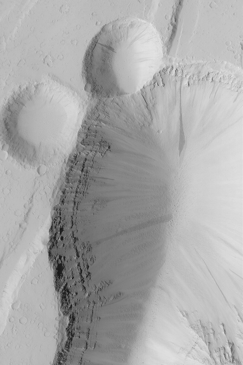
MGS MOC Release No. MOC2-496, 27 September 2003
 NASA/JPL/Malin Space Science Systems |
This Mars Global Surveyor (MGS) Mars Orbiter Camera (MOC)
image, acquired in February 2003, shows pits formed by
faulting and collapse in the Tractus Fossae region of Mars.
The faulting and pitting processes have exposed the layered
bedrock. Boulders, many of them now mantled by dust, have
rolled down to the bottom of the larger pit. Dark streaks
on the pit walls result from avalanches of dust.
This picture is located
near 23.7°N, 104.0°W, and covers an area 3 km (1.9 mi)
wide. Sunlight illuminates the scene from the left.
Malin Space Science Systems and the California Institute of Technology
built the MOC using spare hardware from the Mars Observer mission.
MSSS operates the camera from its facilities in San Diego, California.
The Jet Propulsion Laboratory’s Mars Surveyor Operations Project
operates the Mars Global Surveyor spacecraft with its industrial
partner, Lockheed Martin Astronautics, from facilities in Pasadena,
California and Denver, Colorado.


