Status Report

Mars Odyssey THEMIS Image: Acidalia Planitia 09-24-2002

By SpaceRef Editor
September 24, 2002
Filed under , ,


Medium image for 20020924a

Image Context:
Context image for 20020924a
Context image credit: NASA/Mars Orbiter Laser Altimeter (MOLA) Team
[ Find on map: Javascript version ]
[ Find on map: CGI version ]


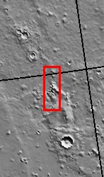
Much of the northern lowlands of Mars are thought to
be relatively young volcanic flows with varying amounts
of windblown dust cover. The lack of impact craters in
this image indicate the young age of the surface. The
lighter spots in the top portion of the image are likely
small volcanic features, either small cones or perhaps
small collapse pits. The appearance of the darker material
abutting or flowing against the higher knobs and ridges is
common in volcanic flow fields.

[Questions? Email images@themis.asu.edu]

[Source: ASU THEMIS Science Team]


Note: this THEMIS visual image has not been radiometrically nor geometrically calibrated for this preliminary release. An empirical correction has been performed to remove instrumental effects. A linear shift has been applied in the cross-track and down-track direction to approximate spacecraft and planetary motion. Fully calibrated and geometrically projected images will be released through the Planetary Data System in accordance with Project policies at a later time.


NASA’s Jet Propulsion Laboratory manages the 2001 Mars Odyssey mission for NASA’s Office of Space Science, Washington, D.C. The Thermal Emission Imaging System (THEMIS) was developed by Arizona State University, Tempe, in collaboration with Raytheon Santa Barbara Remote Sensing. The THEMIS investigation is led by Dr. Philip Christensen at Arizona State University. Lockheed Martin Astronautics, Denver, is the prime contractor for the Odyssey project, and developed and built the orbiter. Mission operations are conducted jointly from Lockheed Martin and from JPL, a division of the California Institute of Technology in Pasadena.

Image Credit: NASA/JPL/Arizona State University


[ Show Full-Size Image (GIF) ] [ Show Full-Size Image (JPG) ]
[ Show Full-Size Image (PNG) ] [ Show Full-Size Image (TIF) ]


ParameterValue ParameterValue
Latitude44.7 &nbsp InstrumentVIS
Longitude318.8E (41.2W) &nbsp Resolution (m)19
Image Size (pixels)2989×1169 &nbsp Image Size (km)56.8×22.2

SpaceRef staff editor.