Mars Odyssey THEMIS Image: Lava Flows in Eastern Tharsis
 |
|
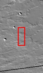
| This image may at first appear somewhat bland — there is little contrast in the surface materials due to dust cover, and there are few impact craters — but there are some very interesting geologic features here. The great Tharsis volcanoes have produced vast fields of lava flows, such as those shown in this image, to the east of Tharsis Tholus. The flows in this image have moved from west to east, down the regional topographic slope. The lobate edges of the flows are distinctive, and permit the discrimination of many overlapping individual flows that may represent tens, hundreds, thousands, or even millions of years worth of volcanic activity (overlapping relationships are especially evident at the bottom of the image). Viewed at full resolution, the image reveals interesting patterns and textures on the top surfaces of these flows. In particular, at the top of the image, there are numerous parallel curved ridges visible on the upper surfaces of the lava flows. These ridges make the flow surface look somewhat ropy, and at smaller scales this flow might be referred to as pahoehoe, indicative of a relatively fluid type of lava flow. At the scales observed here, however, these features are probably better referred to as pressure ridges. Pressure ridges form on the surface of a lava flow when the upper part of the flow is exposed to air, freezing it, but the insulated unfrozen interior of the flow continues to move down slope (and more material is pushed forward from behind), causing the surface to compress and pile up like a rug. Rough-looking flows with less distinct (more random) patterns on their surfaces may be flows that are more like terrestrial a’a flows, which are distinguished from pahoehoe flows by their higher viscosities and effusion rates. Near the center of the image there is an east-west trending, smooth-floored depression. The [Source: ASU THEMIS Science Team] |
NASA’s Jet Propulsion Laboratory manages the 2001 Mars Odyssey mission for NASA’s Office of Space Science, Washington, D.C. The Thermal Emission Imaging System (THEMIS) was developed by Arizona State University, Tempe, in collaboration with Raytheon Santa Barbara Remote Sensing. The THEMIS investigation is led by Dr. Philip Christensen at Arizona State University. Lockheed Martin Astronautics, Denver, is the prime contractor for the Odyssey project, and developed and built the orbiter. Mission operations are conducted jointly from Lockheed Martin and from JPL, a division of the California Institute of Technology in Pasadena.
Image Credit: NASA/JPL/Arizona State University
| Parameter | Value | Parameter | Value | |
|---|---|---|---|---|
| Latitude | 11.7 |   | Instrument | VIS |
| Longitude | 83.6W (276.4E) |   | Resolution (m) | 19 |
| Image Size (pixels) | 3025×1234 |   | Image Size (km) | 57.5×23.4 |


