Mars Odyssey THEMIS Image: Reuyl Crater Dust Avalanches
 |
|
| The Science | The Story | |||
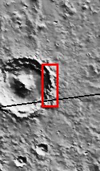
| The rugged, arcuate rim of the 90 km crater Reuyl dominates this THEMIS image. Reuyl crater is at the southern edge of a region known to be blanketed in thick dust based on its high albedo (brightness) and low thermal inertia values. This thick mantle of dust creates the appearance of snow covered mountains in the image. Like snow accumulation on Earth, Martian dust can become so thick that it eventually slides down the face of steep slopes, creating runaway avalanches of dust. In the center of this image about 1/3 of the way down is evidence of this phenomenon. A few dozen dark streaks can be seen on the bright, sunlit slopes of the crater rim. The narrow streaks extend downslope following the local topography in a manner very similar to snow avalanches on Earth. But unlike their terrestrial counterparts, no accumulation occurs at the bottom. The dust particles are so small that they are easily launched into the thin atmosphere where they remain suspended and ultimately blow away. The apparent darkness of the avalanche scars is due to the presence of relatively dark underlying material that becomes exposed following the passage of the avalanche. Over time, new dust deposition occurs, brightening the scars until they fade into the background. Although dark slope streaks had been observed in Viking mission images, a clear understanding of this dynamic phenomenon wasn’t possible until the much higher resolution images from the Mars Global Surveyor MOC camera revealed the details. MOC images also showed that new avalanches have occurred during the time MGS has been in orbit. THEMIS images will allow additional mapping of their distribution and frequency, contributing new insights about Martian dust avalanches. [Source: ASU THEMIS Science Team] | The stiff peaks in this image might remind you of the Alps here on Earth, but they really outline the choppy edge of a large Martian crater over 50 miles wide (seen in the context image at right). While these aren’t the Alps, you will find quite a few avalanches. Avalanches of dust, however, not snow. Martian dust can become so thick in this area that it eventually slides down the steep slopes, creating runaway avalanches of dust.
No dedicated, Swiss-like avalanche rescue teams would be needed much on Mars, however. Unlike snow, the dust doesn’t pile up and accumulate at the bottom. Instead, dust particles are so small that they get launched into the atmosphere where they remain suspended until . . . poof! They are blown away and distributed lightly elsewhere. For evidence of past avalanches, check out the dark streaks running down the bright, sunlit slopes (western side of the peaks about 1/3 of the way down the image). These avalanche scars are dark because the underlying surface is not as bright as the removed dust. Eventually, new dust will settle over these scars, and the streaks will brighten until they fade into the background. The neat thing is that we’ll be able to see all of these changes happening over time. Our current two Mars orbiters (called Mars Global Surveyor and 2001 Mars Odyssey) are showing that avalanche action is happening right now, all of the time on Mars. For example, the camera on Mars Global Surveyor has already taken pictures of the Martian surface in some areas that showed no avalanches – the first time the picture was snapped, that is. The next time around, the camera took a picture of the same area, only voila! New streaks, meaning new avalanches! That’s why it can be so exciting to look at the Martian landscape over time to see how it changes. The THEMIS camera on Odyssey will continue to map out the places where the avalanches occur and how often. This information will really help scientists understand how dust is works to shape the terrain and to influence the Martian climate as it constantly swings into the atmosphere, falls down to the ground, and rises back up again. Stay tuned to see if you too can pick out the changes over time! [Questions? Email marsoutreach@jpl.nasa.gov] [Source: NASA/JPL Mars Outreach] | |||
NASA’s Jet Propulsion Laboratory manages the 2001 Mars Odyssey mission for NASA’s Office of Space Science, Washington, D.C. The Thermal Emission Imaging System (THEMIS) was developed by Arizona State University, Tempe, in collaboration with Raytheon Santa Barbara Remote Sensing. The THEMIS investigation is led by Dr. Philip Christensen at Arizona State University. Lockheed Martin Astronautics, Denver, is the prime contractor for the Odyssey project, and developed and built the orbiter. Mission operations are conducted jointly from Lockheed Martin and from JPL, a division of the California Institute of Technology in Pasadena.
Image Credit: NASA/JPL/Arizona State University
| Parameter | Value | Parameter | Value | |
|---|---|---|---|---|
| Latitude | -9.7 |   | Instrument | VIS |
| Longitude | 192.7W (167.3E) |   | Resolution (m) | 19 |
| Image Size (pixels) | 3043×1237 |   | Image Size (km) | 57.8×23.5 |


