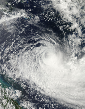
NASA MODIS Image of the Day: March 28, 2010 – Tropical Cyclone Ului

Tropical Cyclone Ului approached the Queensland coast on March 19, 2010.
According to a bulletin issued by the U.
S. Navy’s Joint Typhoon Warning Center (JTWC) at 15:00 UTC March 19 (2:00 a.m. March 20 in Sydney), the storm had maximum sustained winds of 55 knots (100 kilometers per hour) and gusts up to 70 knots (130 kilometers per hour). These wind speeds were down from those of the previous day, consistent with JTWC forecasts of diminishing storm strength. The MODIS on NASA’s Aqua satellite captured this true-color image of the storm on March 19, 2010. Ului spans several hundred kilometers over the Coral Sea. Partially obscured by clouds, the Queensland coast appears in the lower-left corner. Unlike the image from the previous day, this shot shows Ului without a discernible eye, even though the storm retains a typical cyclone swirl shape. The JTWC reported that Ului was roughly 560 nautical miles (1,040 kilometers) east of Cairns, Australia. The storm had been moving toward the southwest over the previous several hours and had dissipated in strength. As Ului moved over land, it was expected to diminish further.


