NASA MODIS Image of the Day: January 17, 2009 – Qatar and the Persian Gulf
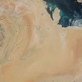
This image of Qatar and the region surrounding it was captured by the MODIS on the Terra satellite on January 7, 2009.
Qatar is the peninsula in the center of the image that juts into the Persian Gulf.
The island kingdom of Bahrain is to the west of Qatar in the Gulf. South of Qatar are two other countries. To the west is Saudi Arabia and to the east is the United Arab Emirates. Saudi Arabia has a central rocky plateau known as Najd. You can see this region on the left side of the image, west of Qatar – it has a series of long escarpments running north-south, the longest and highest of which is called Tuwaiq. The Tuwaiq escarpment runs approximately 800 km with narrow valleys along its sides. In its central section are towns, include Saudi Arabia’s capital Riyadh.


